Some Boundaries Are Worth Preserving
Running through the most-visited wilderness in the continental United States, rallying to its defense.
The Boundary Waters Canoe Area Wilderness (BWCAW) is a 1.1-million-acre wilderness tucked away in northern Minnesota and made up of interconnected waterways of lakes, rivers, streams, bogs and marshes. The BWCAW is located within the Superior National Forest, which has 20 percent of the fresh water in the entire National Forest System. It is one of the last places on earth where you can drink straight from the lake.
This amount of fresh water is what is incredibly special about BWCAW, and also what places it at risk. All the water is connected. A source of pollution at any point would instantly spread across the sprawling water-based wilderness to disastrous effects. The Chilean mining giant Antofagasta is currently proposing a massive sulfide-ore copper mine directly adjacent to the BWCAW. This type of mining is America’s most toxic, and responsible for the most Superfund sites in the country. The acid drainage from sulfide-ore copper mining pollutes ground and surface water no matter what precautions are taken. That’s why I’m running across the Boundary Waters, to raise awareness among trail runners about the value of this place. The Boundary Waters is not the right location for this sort of mine.
I grew up camping in the Northwoods. When I was a kid, my grandparents and parents spent the majority of our vacation time here or exploring many of America’s other public lands. My wife and I now have the pleasure of introducing our three kids to the wilderness and other public lands, and watching them experience nature firsthand as they explore, test their limits, read in hammocks, build fires, learn to paddle, navigate maps, and so much more. These are all quintessential life experiences. Wilderness is a classroom for understanding a lot of things about the world—planning and preparation are paramount, you come to expect the unexpected, roll with changes, overcome obstacles and work as a team.
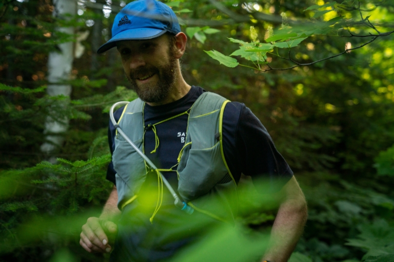
A unique aspect of my advocacy is that people see the Boundary Waters as canoe country, and rightfully so. But in addition to world-class canoeing, this area is also home to hundreds of remote wilderness backcountry trails. So, it’s my idea to collectively run hundreds of miles in a landscape of over 1,100 lakes to bring a different perspective to our fight. Typically, the trails are used as multiday hiking and backpacking routes, and all of them are remote, rugged and wild. There are only two human-constructed bridges on any of these trails—the rest are formed from beaver dams or fallen trees. The trails themselves cut through the only section of the Canadian boreal forest in the Lower 48 and are some of the rockiest and rooted trails I’ve ever run on. Often times they’re flooded (again the beavers) or blocked by downed trees or hard to follow as they wind through recent forest fire areas.

On trails in the Boundary Waters. Photo: Brendan Davis
I started my project in 2019 intending to run both the Border Route Trail (BRT) and the Kekekabic Trail (the Kek) individually, and then combine the two this summer for one long 110 or so mile run east to west across our cherished canoe country. However, this year, with the COVID crisis in full swing, the logistics of organizing the trip started to break down. I couldn’t safely organize friends and family to travel and support me. The run was probably going to take close to 40 hours and on these trails, I can’t run with the amount of food and gear that I would need without some resupply options. A critical and exciting aspect I was looking forward to was the paddle-in aid stations. Participants would meet me on the trail in the middle of the Boundary Waters with food and supplies. It was in this way I was planning on getting professional athletes to participate and see the Boundary Waters for themselves.
But with lemons, make some backcountry lemonade. This summer, to keep the drumbeat of trail-running advocacy going, I’m instead running a series of trails in addition to re-running the BRT and the Kek. These trails are all 20 miles or more in length (I’m also adding in Eagle Mountain connected with the Brule Lake Trail for another 10 or so miles up the highest summit in Minnesota, at a nose-bleed altitude of 2,301 feet!) and wind their way throughout the heart of the Boundary Waters.
My love for this place has only grown as I’ve traded a canoe for trail-running shoes. Trail runners depend on vast expanses of protected landscapes to run. The West has so many mountains and deserts—some of which I’ve been able to run through as well. Discovering a place by foot gives a visceral, unique perspective and increases appreciation for the land. While running through the Boundary Waters I’ve seen moose and bears, been bitten by at least a million mosquitos, jumped in lakes and streams to avoid heat exhaustion, and refilled my water supplies from the waters around me while rushing along the trails. I’ve panicked once or twice from being lost, turned off the trail onto a portage route between lakes and had to backtrack a mile or more. I’ve stopped for blueberries, raspberries and thimbleberries, taking advantage of nature’s aid station food supply. I’ve been rained on and snowed on. I’ve watched eagles soar at eye level as I paused on 300-foot cliffs to look out over the wilderness. I’ve gotten sunburned, broken a toe and have permanent scars on my shins from wild rose thorns. I’ve seen the sun rise over the United States and set over Canada on the same run. I can’t begin to describe the feeling of being so small while so connected to one million acres as I’ve run through this wilderness and hoped this place will be around for generations to come.
I’m actually writing this right now on a scrap of paper in a tent at a Boundary Waters campsite looking across the lake into Canada. Beside me, taking a nap after a long (and unsuccessful) early morning fishing expedition is our 10-year-old, Donnie. A rite of passage in our family is a big-kid-and-dad trip into the Boundary Waters when one of our kids turns 10. These trips are not like our full family trips—the big kid has to carry more and do more camp chores, and they are the only other paddler. They also help plan the trip, including necessary gear, clothes and food. Since it’s their big trip, they also get to pick where we go, and Donnie wanted to see two things: a huge waterfall and one of the trails I ran last year. We headed to Rose Lake, which is the midpoint of the Border Route Trail and has a large and beautiful waterfall.

Paddling on Rose Lake. Photo: Alex Falconer
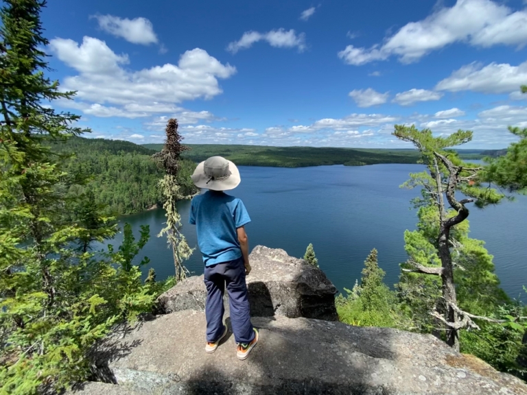
On the third and last full day, Donnie declared “I want to go for a trail run.” Our campsite was one of the very sites I stopped at for a food break last summer and is also on the only flat section of the entire 65- mile trail. There are roughly 5 miles that run alongside Rove and Rose Lakes, with the Canadian border straddling a small stream connecting the two. The trail then climbs several hundred feet up palisades, with the reward of sweeping views of the lakes and Canada and over to the famous waterfall at Stairway Portage. We headed east from our site on the flat part and past where I saw a bear last year and stopped for raspberries along the trail. We discovered a new beaver dam that had flooded about 300 meters of land and turned around. Donnie said he wanted to go for a mile, but he never stopped hopping off boulders, bouncing around roots, slogging through mud and jumping off fallen tree trunks, and it wasn’t long before he hit three miles—his first-ever 5K distance. And he did it on the trail that nearly conquered me last year, resetting in my head what this trail is all about. Last year, with heat exhaustion and a broken toe, I was battling it out to just make it to the other side. This year, listening to Donnie’s laughter as he bounded about, I could have stayed on this trail forever.

Camping with Dad. Photo: Alex Falconer
We need places like this in our lives. Getting out into our public lands allows us to slow down, truly look around and be present. We need to save the Boundary Waters, Bears Ears and Grand-Staircase Escalante, the Red Desert, the Tongass, the Arctic Refuge, and so much more. Once destroyed by extraction industries driven by short-term greed, these wild places will be lost forever. We have a choice right now—to let giant corporations take and take and take and leave Superfund sites and bankruptcy in their wake, or to protect the wild and remote places and keep them as they are for our kids and all generations to come.
I hope these runs and images can inspire others to come and experience the Boundary Waters for themselves—by canoe or by trail. But more importantly for now, I hope people will see this place, wherever they are currently located, and decide to join the fight to stop this horrific project. Hopefully one day, without the urgency of now to protect this place, people will still be able to come and experience this quiet place. It is up to us to save it.
Right now, there is a bill working its way through Congress—H.R. 5598, the Boundary Waters Wilderness Protection and Pollution Prevention Act, authored by Representative Betty McCollum. This bill will permanently remove the threat of sulfide-ore copper mining from the watershed of not only the Boundary Waters but also Voyageurs National Park and the Canadian Quetico Provincial Park. Three protected landscapes are at peril from this proposed mine. You can join the fight at Patagonia Action Works.
Support the Boundary Waters Wilderness Act
Contact your member of Congress to support H.R.5598 and protect 234,328 acres in the Superior National Forest from copper-nickel mining development.

