Tackling All of California’s 14ers by Bike, and Only Getting a Little Lost
Groggily I stirred in the sweaty musk of my sleeping bag. I’d spent the night on the hard concrete slab directly outside the Independence campground’s pit toilets, with the wafting stench of shit enveloping my fitful slumber. I shut my eyes, trying to forget where I was. My hips were sore, my kidneys ached and the first few lines of Radiohead’s “4 Minute Warning” played eerily in my head:
This is just a nightmare
Soon I’m gonna wake up
Someone’s gonna bring me ’round
Three days before, I watched as Jess’s car pulled away from the Tuttle Creek Campground in Lone Pine, California, leaving me alone in the dusty desert to worry about the challenges of the days to come. Nine days, fifteen 14,000-foot peaks and countless hours of running and biking. My lofty goal was to tackle all of the peaks in California over 14,000 feet completely under my own power: running and biking, solo and unsupported.
After a warm night on the desert floor, I awoke to a milky canopy of stars. It was 2:35 a.m., 10 minutes before my alarm was set to go off, but I was tired of waiting. By 3 I was shuffling up the Tuttle Creek drainage en route to Mt. Langley. The early morning was still, and it felt good to finally be moving. Following a “user” path I soon found myself needing to cross a wet granite slab. “Is this the way?” I hesitated. But opting for relentless forward progress, I used a small ledge of mud and moss to gain my purchase to the other side.

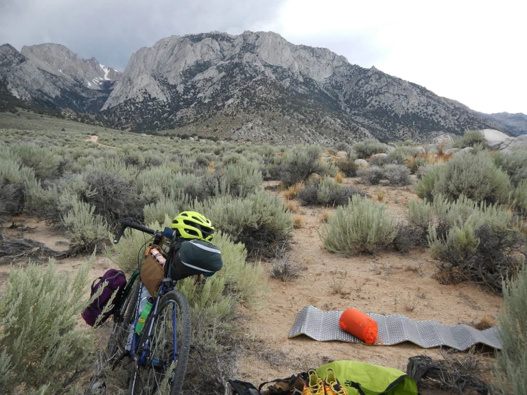
First night’s camp at Tuttle Creek. Photo: Erik Schulte
Once across, I found a roaring waterfall blocking my way. I stared for a few moments, water rushing down and out of my headlamp beam into darkness, and imagined myself slipping and falling out into the unknown. I opted for a retreat back across the mossy ledge. Once on the other side I found a 100-foot layback section that took me straight up to what looked to be a flatter plateau above the waterfall. Relieved not to be falling to my imagined death, I found the bit of unexpected climbing enjoyable and soon I was back on my way to Langley.
I arrived at the top by 7:30 a.m., a mere hour and a half behind my unrealistic (as I would soon realize) schedule. But this would be the theme for the rest of the day. Slow route-finding through trail-less meadows and passes, over car-sized granite boulders and up lingering snowfields, I felt more alone than ever. When I finally caught sight of the Mt. Whitney trail, I was ecstatic. No more route-finding, I could just put my head down and charge.
I bombed down the scree slope out of pure joy. Muir, then Whitney, simple trail, and shuffling past the hordes of hikers who all commented on how fast I was moving. I didn’t feel it.
Atop Mt. Whitney I peered over its sheer east face. So close to the edge, but further from my own edge than I had felt all day. When you go out into the mountains solo, your perceived edge is much closer than you would have ever thought. There is no one else there for you to lean on, no one to help make decisions or determine whether this is the right route. I would learn that lesson again and again as the trip continued, but the down climb off of Whitney en route to Mt. Russell would be illuminating.
Initially I descended the Mountaineer’s Route, but I soon had to leave the relative comfort of that well-traveled path to drop down into the basin between Russell and Whitney. I found myself cliffed out and down climbing some low fifth-class cracks. At one point I leaned on a boulder jammed in one of the cracks and the whole thing shifted a few inches and resettled. Momentarily paralyzed by such a stupid move, I gazed down the hundreds of feet of granite below me. “Comfort” is a relative term, but when you expose yourself to a situation where you have no choice but to move forward in order to get out, you begin to stretch your perception of reality. There is no aid station to drop in at in the next few miles, no crew to hear your complaints. For a second as I paused there, foot and hand anxiously jammed into the crack, I felt like this was all too much for me to handle. The basin was endless feet below and Russell loomed ominously on the other side. My only options were to lie down and probably die there or to move forward. It wasn’t really much of a choice.
The day before I’d planned on the first day taking about eight or nine hours, putting me comfortably back at my bike around midday. That, I’d thought, would give me time to eat and then make the trip up to Shepherd Pass trailhead before nightfall. From Highway 395 the Eastern Sierra juts dauntingly up out of the sage-covered desert: 7,000 to 8,000 vertical feet above, the peaks loom like angry monsters daring you to approach. Their sheer volume, in contrast with the lowness of the desert hills, gives the impression that they are almost close enough to reach out and touch from the comfort of your car as you drive along. But those who venture into their midst soon find that everything on the East Side looks much closer than it actually is.
The planned eight or nine hours of my first day quickly turned into a full 15 hours before I was back at the bike. Nonetheless, thrilled to have overcome so many obstacles and setbacks, I giddily hopped on my bicycle and cruised down into Lone Pine for dinner. By 8:30 p.m. I was back on the highway en route to Shepherd Pass. The riding was slow, and I should have drank more water along the way. By 11:30 I pulled my bike off the dirt road, set up my bed and crashed on the sandy desert floor.

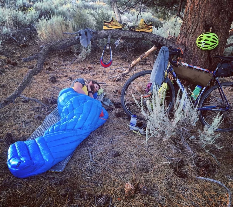
Pine needle camp sight. Photo: Peter Snow
On day two I was more casual about my start, and after a brief ride I was on the trail, running, at about 7 a.m. About a quarter mile in I tried to scratch my head and realized I still wore my helmet. “Damn!” I cursed myself for not being more aware. I quickly stashed it on the John Muir Wilderness sign and hoped no one would take it. “I wonder if that is a bad sign,” I thought, but quickly rebutted, “Signs aren’t real, stupid. Keep moving.” It seemed that I was also talking to myself.
I would soon change my opinion about signs as the next one came in the form of urine. As I pulled off the trail and relieved myself for the first time that day I was horrified to look down and see a stream of blood red instead of the normal light yellow. Unsure of the severity of this new sign, I opted to see what future pees would hold. I pressed on, drinking all my water, and by the second time I peed I had made it to the Anvil Camp on the Shepherd Pass Trail. As signs go, this one was worse: dark red. “Shit.”
This was probably a sign that I should turn around, regroup, take a rest day and re-tackle this objective tomorrow. Instead, I lay there in the meadow next to the creek drinking copious amounts of water as a doe grazed nearby, suspiciously keeping an eye on me. After a couple hours of this, my pee began to return to normal. I decided to keep moving forward.
For the rest of the day my movement was slow and creaky. Once atop Shepherd Pass I bumbled through the SUV-sized boulders guarding the route up Mt. Williamson. Too many route-finding mistakes, too slow, too much stress on the body. By 3 p.m. I was at the base of Williamson, looking up at the 2,000 feet of vertical gain needed to stand on top. Thunderheads were looming over the top and clouds were building farther out west. My mind slowly processed the situation. I knew I was moving too slowly, and with the fear of getting caught in a thunderstorm atop a giant hunk of granite I made the tough call to turn back.
“I wish this was an Ultra,” I thought. Then I could have dropped, hopped in the nearest car and wallowed in my own sorrow. Instead, I was 15 miles away from my bicycle, which sat baking in the desert sun 8,000 feet below. Tears slowly dripped down my cheeks, and the clouds began to open up as I morosely stumbled back down the trail. Back at the bike, mentally drained from the day, I huddled in the shadow of another hiker’s car, flicking ants from my sunburnt legs, trying to process my next moves. I called Jess, hoping for an easy answer. I rinsed in the creek, made a couple cups of ramen and loaded up my bike for the long, dusty ride into Independence.
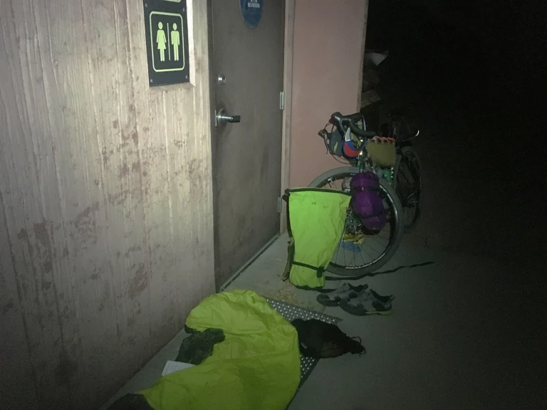
That night I ate an overpriced burger at the only restaurant in town, and when I left to find a spot to sleep for the night a storm had begun to blow in. The dark streets had a lonely feel to them, and the wind whipped sand and dust in my face. Nothing comes easy. Once at the campground, my only reprieve from the raging storm was the cement slab directly in front of the campground’s only set of pit toilets. I lay down that night as rain poured around me, trees thrashed in the wind and the stench of a summer’s worth of piss and shit enveloped me: a fitting end to a rough day.

Pit Toilet Campsite, Independance, CA. Photo: Erik Schulte
The next morning I awoke in a haze, feeling the ache from the previous day’s work not in my legs but in my kidneys. “Arrgh.” With some food, coffee and deliberation with friends over text message, I decided to bail on the objective—but there was still the pesky problem of getting home. There were some 300 miles between me and the comfort of my bed, and no one around to care about my self-inflicted plight.
With my options limited to one, I loaded up my bike, pointed my wheels north on Highway 395 and started pedaling home.

